Renewable Energy recipes II – feasible sites for PV projects
By Agostinho Miguel GarciaContinuing my series on recipes for procedures to support Asian countries in developing Renewable Energies, I am going to address the feasibility of sites for PV projects. One may think that it is obvious that some sites are not feasible: mountains, wetlands, rocky outcrops, coastal lines, water catchment areas and others. However the question then becomes are such types of sites really not feasible?
Let us start by the basic ingredients, which can also be used as a check list. No need to go further if you cannot find the one before:
- power evacuation
- orientation and area
- slope
- soil type
- access
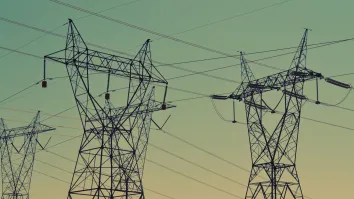
It may strike some of us as odd, but the top selection criteria for a site for PV projects is the power evacuation. No generation project exists without transmission, so make sure that you have identified the transmission lines that are nearby, their capacity and the substations to where they are linked to. Some thumb rules: 33 kV lines: maximum 25 MW for a single circuit and 50 MW for double circuit; 132 kV: maximum 80 MW for a single circuit and 160 MW for a double circuit; 220 kV: maximum 180 MW for a single circuit and 360 MW for a double circuit. For all cases an overshoot of around 10% is possible for short distances, anything below 10 km. This is also not a big problem since solar rarely will be generating the maximum AC nameplate capacity, which again allows the cables/conductors to be stressed for some short periods of time. It is important to get the right and accurate figures from the local transmission company or run some simulations of the transmission lines under the expected temperatures of the location. The numbers provided before may be optimistic for very hot locations with ambient temperatures beyond 45 to 50ºC.
Second part are the grid substations. There are two checks: existing bays for connections or free space to add them and the existing transformers in case the power generated is intended to be stepped up due to limited local consumption (typically the case).
When you have understood that a certain capacity can be evacuated by the transmission lines nearby and accepted by the substation and that adding a bay or using an existing bay is possible and that enough transformer capacity is available or they agreed to add capacity, you may proceed to look at the site. The size or area of the site should match the capacity to be evacuated, but here look for as much land as you can and then if necessary choose within the available land. Use 2 hectares per MW, but understand that the right number is not “one size fits all”. The footprint depends on the latitude of the site. The sun will cast shadow on the next row of modules and that will tell you how close or how far the modules can be. This clearly depends on the tilt of the modules which is directly linked with the latitude of the location. Next issue is the efficiency of the modules. The same area of module may yield, for example, from 300 to 360 Wp and that tells you that with the same area you could have 20% more of installed capacity. So 2 hectares per MW allows several efficiencies of modules including some thin film or also up to a high latitude of 40 to 45º.
The orientation of the land is also very important. Is it towards south or north? Earth is tilted 23º in relation to the sun axis which means that below 23º north and above -23º south the Sun will actually come on both hemispheres. The lower it is and you split between north and south is 50% If it is really low, like below 10º the north south orientation is not that important, but try to choose a flat area. Clearly under such situations and when land is scarce (islands) rooftops, shading structures are much more interesting that laying almost flat modules over the land occupying it. If you are higher than 10º on the northern hemisphere look for sites towards south and not towards north, though there may be some tolerance for some northern facing. If you are below 10º in the southern hemisphere look for northern facing sites and some tolerance can be given for some southern facing. If you are above 20º north look for south facing only and if below 20º look for north faxing only. Avoid funny geometries. The best are squares and rectangles. Do not get frustrated if you cannot find it. It is normal: land registry is hardly a geometrical exercise.
Great, you have a connection, you have a nice land size and suitable orientation. The slope of the land is the next on your list. Slopes higher than 10% are usually not feasible at a nice cost, let us put it this way. In engineering anything is feasible, it just depends on money and time. So undertake a topographic survey and do your slope analysis and if it is really steep all over, consider looking somewhere else, if some pockets are ok, then analyse the feasible portion on your total identified land. If you got scattered small pouches, look elsewhere, if there is a substantial portion that is within the maximum slope and is not all the maximum slope, you may continue. On lands that have steeper slopes facing south (northern hemisphere) or north (southern hemisphere) please do not be naive to think that they are perfect. To build structures you need a horizontal surface. Your site is not a rooftop. Thus such sites are usually as bad as any other site with such slopes. To make them viable terracing is required and if you encounter such sites, just look around and see how farmers are using the land. You are likely to see the same pattern.
The next point on your list is the soil type. This plays a major role on the costs of the foundations and also anything that you need to build or place out there. Thus commission a geotechnical survey with soil samples and it will tell you how hard or soft your land is and the recommendation for the depth of your foundations or even if the soil must be all strengthened. The former is usually good news while the latter is the worst news. There are a lot of technicalities related to geotech surveys. Do engage experts to analyse the report if you are not comfortable with some of the recommendations made. Rocky and hard sites can be developed using cement platforms while soft sites can be developed by ramming the foundations straight into the ground. The latter is cheaper and more desirable, but the former does not mean the end of the world.
The last step is how do we access the site. If all the other basic ingredients are checked, then the access can even be built if necessary. Unless it is a 100 km road for a 10 MW project. Clearly some reasonable amount of access can be built that should be in line with the size of the site. But you want to avoid that, so look for the nearest accesses, their width and also type of road. Asphalted roads is what you want as close to the site as possible with an access to a highway or a primary local access road. All sandy/dirt roads must be upgraded to asphalt. This may also be a good opportunity to benefit local communities by providing them with better accesses and roads. Identify the suitable path, discuss with the local mayors, village elders, etc and plan for a route to be developed.
There are firms that dedicate themselves to site selection and analysis, as mine for example. We do this in a more professional way and with neater tools, namely by doing a GIS analysis (Geographical information system), which is nothing more than running a simulation with a bunch of maps: slope, land usage, soil types, transmission lines, roads, railways, villages, towns, irradiation, temperature, wind, etc. All of those maps allow scenarios to be built and ran that will return land that basically fits under the desired conditions.
You may have noted by now that no solar irradiation potential was included in the basic ingredients. The reason is that solar irradiation is a criteria to be used for site comparison rather than site selection. If you have identified 5 sites and you want to develop only the best one, the solar irradiation and other parameters come into play, otherwise the site selection must not actually look at the solar irradiation, though it is a parameter that it will be required sooner or later.
Going back to the initial question: are mountains, wetlands, rocky outcrops, coastal lines, water catchment areas not feasible? I would say that by now you know the answer and if not just run the check list and you may be surprised that some of these sites may actually be partially feasible.






 Advertise


